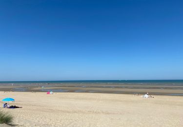
7.8 km | 8.4 km-effort
GR_5A_Wandelronde_Vlaanderen-Zuid
wandelroutes
User
Length
433 km
Max alt
162 m
Uphill gradient
3540 m
Km-Effort
480 km
Min alt
-7 m
Downhill gradient
3552 m
Boucle
No
Creation date :
2014-12-10 00:00:00.0
Updated on :
2014-12-10 00:00:00.0
--
Difficulty : Unknown
FREE GPS app for hiking
About
Trail Walking of 433 km to be discovered at Flanders, West Flanders, De Panne. This trail is proposed by wandelroutes.
Description
More information on : http://www.wandelroutes.org
Positioning
Country:
Belgium
Region :
Flanders
Department/Province :
West Flanders
Municipality :
De Panne
Location:
De Panne
Start:(Dec)
Start:(UTM)
470453 ; 5659779 (31U) N.
Comments
Trails nearby
Circuit de la dune fossile
Walking
Very easy
(3)
Ghyvelde,
Hauts-de-France,
Nord,
France
Unknown
Yes
St. Idesbald et Noorduinen
Walking
Easy
(2)
Koksijde,
Flanders,
West Flanders,
Belgium
4.5 km | 4.8 km-effort
1h 4min
Yes
20240613 - TOTEMUS partiel - DE PANNE 16 Km
Mountain bike
Easy
De Panne,
Flanders,
West Flanders,
Belgium
15.9 km | 16.8 km-effort
2h 26min
No
20240612 - TOTEMUS De Panne - 6.7 Km
Walking
Medium
(1)
De Panne,
Flanders,
West Flanders,
Belgium
6.7 km | 7.3 km-effort
1h 39min
Yes
Gr5A Bray-Dunes / Nieuport
Walking
Medium
(1)
Bray-Dunes,
Hauts-de-France,
Nord,
France
28 km | 31 km-effort
6h 56min
No
Artiestenwandelroute
On foot
Easy
Koksijde,
Flanders,
West Flanders,
Belgium
9.2 km | 9.9 km-effort
2h 14min
Yes
Westhoek wandelroute
On foot
Easy
(1)
De Panne,
Flanders,
West Flanders,
Belgium
11.2 km | 12.2 km-effort
2h 46min
Yes
w-belgie-westhoekreservaat
Walking
Very easy
(1)
De Panne,
Flanders,
West Flanders,
Belgium
9.8 km | 10.6 km-effort
Unknown
Yes
Coxyde
Walking
Medium
Koksijde,
Flanders,
West Flanders,
Belgium
9.3 km | 10.3 km-effort
2h 58min
Yes